Showing posts with label AT. Show all posts

Monday, July 15, 2013

May 29th - June 4th, Day 44-50: Marion to Pearisburg

So for these next couple of posts, I am just going to do multiple days at a time. I will definitely try and put up full posts at some point, but right now I am just a tad busy, you know, hiking.

May 29th, 2013 to June 4th, 2013
Day 44 - Day 50
Marion to Pearisburg
119.9 miles, 630.8 miles total

At this point, I am hiking with Avo, a guy in his 30s, and Roam(e)(?), previously mentioned as Alana.

Day 44 and 45 - Marion and onward - 19.8 miles, 7 miles

We hiked 19.8 miles to the Mt. Rogers Visitor Center outside of Marion, VA. There is a really nice shelter there called the Partnership Shelter, and it has showers (!), but it was being taken over by some rather sketchy people, so we decided to get a motel room in Marion. After a nice night of resupply and A/C and TV, and some time the next day at the library, we headed out and hiked a short 7 mile day to the next shelter.


Day 46 - Officially Zeus - 18.4 miles

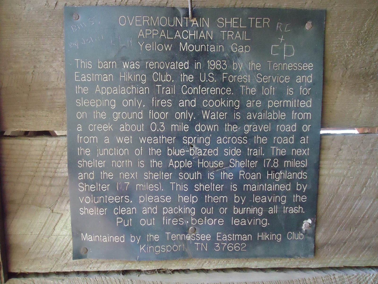
Today we passed the old Lindamood Schoolhouse on our hike as well as a restaurant called The Barn, where our meals were paid for by some section hikers just being trail angels. That is one of the reasons I love hiking the trail. People are so nice to you because they truly want to help you on your journey. Today, we also reached the 25% mark! Woohoo! Still a ways to go, though. But I also solidified my trail name today.

Trail names are usually given to hikers by people with whom they are hiking, and they come from something they do or something they said. For example, when Avo resupplies he always gets an avocado for each day he will be on the trail. Rome says "when in Rome" a lot, and also likes to say she is just roaming the AT for six months or so. Anyways, my trail name is now Zeus, for multiple reasons. First of all, Avo says that I simply hop on my lightning bolt to get to the next shelter. Secondly, we like to joke that I can summon trail magic at will because there was a time today where we didn't really want to go any further, but still had some miles to the next shelter. Avo requested that I summon up some trail magic, since he had been calling me Zeus all day. I said, "Don't worry about it. I got you." Surprisingly, at the next road crossing, there were sodas and snacks waiting for us. So there you go, I'm Zeus, I can summon whatever you need, and use my lightning bolts to travel the AT.


Day 47 - Just another day - 19.1 miles

Today was just an average day: some uphill, some flat, rocky terrain, and some downhill. Although near the end of the day, the downhill felt like it would never end. We thought we were going to be at the shelter around an hour before we finally arrived. That was rough. Even worse, just before the downhill, there was trail magic, but it was all gone! That really gets you down when it's getting late and you're tired.

On the upside, we passed a pretty cool shelter called the Chestnut Knob Shelter. It was completely enclosed, had a door, and was on top of a bald with a great view. It was an excellent lunch spot.


Day 48 - Rain, and more rain, and 24 miles - 23.8 miles

So it was pouring all day, we were all completely soaked by the first shelter, but we had already hiked 14 miles by 1PM, so we decided to push on even through the soggy shoes and clothes. But there was something really cool that happened today, I saw a baby deer. The fawn couldn't have been more than a few hours old. It was still walking pretty awkwardly, getting used to its legs. But the exciting part is how I encountered it. We were hiking uphill, naturally, and I saw a deer and its fawn up ahead, but they ran away down the trail. Luckily, about 50 yards later, I see them again, and the fawn runs again, but this time, towards me! It was almost as if the fawn was trying to bluff charge us! It stopped literally a foot in front of us and just stared up at us. Avo got a really good picture, and I'm trying to get him to send it to me. I could tell the mother deer was freaking out, trying to decide whether we were a threat or anything, but eventually they both just turned and started climbing uphill to the right side of the trail. It was such an amazing experience to see young fawn so up close!


Day 49 - Woods Hole Hostel - 21.4 miles

About six miles after we started, we crossed a road that led to a convenience store half a mile away. After a nice late-morning chocolate milk and snack, we headed to Dismal Falls, which is a really nice swimming hole with a small waterfall leading into it. After a brutal uphill, the trail flattened out a little and we dragged our tired legs into Woods Hole Hostel, a hostel that places an emphasis on sustainable living with bee keeping, farming, organic gardening, and yoga. They also have an excellent breakfast.


Day 50 - Pearisburg, VA - 10.4 miles

We spent most of the morning just hanging out at the hostel, eating breakfast, relaxing, drying out clothes and such. The hike today was quite nice and mostly downhill into Pearisburg. There was a really nice overlook called Angel's Rest about 2.5 miles outside of town. Once we got into town we ate dinner at an all-you-can-eat Chinese buffet place called Lucky Star, and then we resupplied from the Food Lion next door.


May 28th - Day 43: Was that a fighter jet? Sweet!

May 28th, 2013 - Day 43
Whitetop Mountain Road to Hurricane Mountain Shelter
22.7 miles, 510.9 miles total

Well today was another long one, but it was definitely a good one. I saw a lot of cool stuff today. First of all, I passed by Mt. Rogers, the highest peak in Virginia. It's all downhill from here, kinda. Anyways, right around Mt. Rogers, I started to hear this loud booming noise that sounded like an airplane way up in the sky. The only thing different was that the noise kept getting louder, like really loud. And then I see it, and then it's gone. A fighter jet (probably an F-22 Raptor, according to Avo, who was in the Army) had just flown directly over and then banked over Mt. Rogers. It was a pretty neat experience. Throughout the day, I continued to hear fighter jets fly by in the distance. Later in the day, I also saw a V-22 Osprey flying in the distance. But I saw it twice, once as a helicopter, with its rotors horizontal, and then later, with its rotors vertical. It was quite interesting to be so close to such technology, and yet so far away.

Aside from the aircraft, I also saw plenty of wildlife today. Today I was in the Grayson Highlands State Park, where they have wild ponies that graze on the open fields of grass. A lot of times the ponies will simply walk up to you and not even be afraid. I have even heard stories of people waking up in a shelter to wild ponies sticking their heads in as if to say, "HEY! What are y'all doing in here?! Can I have some of that?" I also saw some cows and deer, and even a little fawn curled up in the bushes on the side of the trail.

Today I also passed by the "Fatman Squeeze", which is a rock tunnel on the AT, and it's actually quite difficult to get through with a pack on. I finally caught up with Avo, at a shelter in the late afternoon, where we were escaping an afternoon shower. Luckily, the rain let up just enough for us to reach our final destination for the night without getting too soaked.

May 27 - Day 42: Leaving Damascus

May 27th, 2013 - Day 42
Damascus, VA to Whitetop Mountain Road (tenting)
21.1 miles, 488.2 miles total

So today I got kind of a late start. It is always more difficult leaving town. First of all, your pack is about 10 lbs heavier because of all the food you are now carrying. Second, it is really easy to get used to the town life - not having to carry your pack everywhere, eating whatever you want, SODA. But luckily after a few miles back on the trail, it all comes back to you and you realize why you love hiking so much. After eating breakfast at a gas station/convenience store called Cowboy's (I know, sounds sketchy), I headed out on a full stomach.

The first few miles were quite rough, because they were all uphill and I had a full pack. I passed Frodo after only 4 miles even though he started 2 hours before me. He was clearly still recovering from his sudden sickness yesterday, and just didn't have the energy to go very fast.

One cool thing about Damascus is that the Virginia Creeper Trail goes straight through it. I have biked the VA Creeper multiple times, but I never knew it crossed the AT. It was fun being able to see it from a different perspective. I actually hiked up the VCT for a mile or so, because there was a detour in the AT. Apparently, one of the bridges got completely washed out, so the AT was rerouted onto the VCT for a bit.

I finally saw my first rattlesnake today! I was finally getting into a groove and was just zoned out, and the rattler completely startled me. I clearly startled it as well, because it immediately began shaking its tail at me. I wasn't going to continue with it sitting right next to the trail like that, so I simply waited for it to move on. Rattlesnakes are venomous and their bites can be fatal depending on the amount of venom they decide to inject. A rattler that was simply startled like this one (vs being stepped on or provoked) would be less likely to inject a fatal amount of venom, or any venom at all.

Anyways, I got to a shelter around 5:30 or so, but I was really eager to catch up with Avo, who left Damascus yesterday, so I decided to push on to a campsite near the summit of Whitetop Mountain...meaning my final 5 miles or so would be all uphill. I finally reached the campsite around 8PM and now I feel extremely accomplished. Another long day awaits, and I have a good feeling I will sleep very well tonight.

Thursday, May 30, 2013

5/21/13 - Day 36 - Goodbye NC!

Roan High Knob Shelter to US 19E (Mountain Harbour Hostel)
15.8 miles, 391.6 miles total

Today was pretty long. I woke up bright and early to start hiking. The hike today was filled with balds. I believe there were 4 or 5. I also visited the Overmountain Shelter, which is a barn converted into a shelter which can hold 20 hikers, possibly more. It also had a great view.

The two main obstacles of today's hike were Little Hump and Hump Mountains. Hump Mountain has a few false summits, so basically you think you've reached the summit, but then realize you have 100 more yards to go. That happened three times.

About halfway down from Hump, I saw a sign that says "Leaving NC." Technically, I have probably left NC a few dozen times so far (since the AT follows the NC-TN border for a few hundred miles), but this will be the last time. Alright, two states down, twelve to go! Let's do this! And goodbye NC! See you later!

Also, when I was on top of Hump, I could see Grandfather Mountain and Sugar Mountain (where Lutherock is), so that was pretty cool.

Tonight I am staying at a hostel, but it's full so I am tenting. There was a free shuttle into Roan Mountain (the town), so I went to a restaurant called Bob's Dairyland, and had the Holy Cow burger. It had three 5 oz hamburger patties, six slices of bacon, three slices of deli ham, three slices of cheese, two onion rings, and one scoop of chili. I also got a 32 oz mint chocolate chip milkshake. All worth it.

When I got back, some people in the hostel were watching Back to the Future, so I joined them, then we watched The Mask. It was all in all a pretty good night.

Unfortunately, around 10PM, a huge thunderstorm passed over. I was in my tent, in a deluge, and it didn't leak at all. I was bone dry all night, but the thunder and lightning were a bit unnerving, especially with a piece of fabric being the only thing separating me from them.


5/20/13 - Day 35 - Highest Shelter on the Trail

Cherry Gap Shelter to Roan High Knob Shelter
16.8 miles, 375.8 miles total

Overall, today was a good day. The weather was excellent, clear and sunny. But this morning was rough. Putting on soaking wet underwear, pants, socks, and shoes, and then hiking in them is quite possibly one of the most miserable things about the AT. Luckily, everything pretty much dried throughout the day.

Since it rained all night, some wildlife came out onto the trail that doesn't normally appear. I saw a lot of earthworms, as well as quite a few small orange salamanders.

Roan Mountain is one of the tallest mountains on the AT, and there is only one way to get to the top: climb. Okay, well, hike, but it was one of the most challenging ascents so far, especially since it was at the tail-end of my day.

This shelter is the highest one on the AT, sitting at nearly 6200 feet above sea level. Unfortunately, there isn't really a view to anywhere since the shelter is surrounded by pines. Tonight, in and around the shelter are Ninja, Mess, MacGyver, and Sugarpie (or something like that, I didn't really catch her name, she's headed south).

5/19/13 - Day 34 - Some Rain, Some Hail, the Usual

Nolichucky River to Cherry Gap Shelter
17.5 miles, 359.0 miles total

I got dropped off this morning at River Rd, where I left, by my "friend" Zack, who promptly wish a hailstorm to open up on me. More on that later.

Today, I hiked a route that Lutherock does with campers, but backwards (uphill) and longer (twice as long). Anyways, about 10 miles in, right around Beauty Spot near 3PM, it started to pour, and then guess what happened... it started to hail. Thanks, Zack.

So it was miserable and raining for the next 2.5 hours, but I just kept hiking to the next shelter so I wouldn't have to set up my tent in the rain. There was also quite a bit of thunder and lightning. That was actually kind of scary and nerve-wracking. Most of the afternoon I was hiking up what was pretty much a creek at that point. Luckily the last hour that I was hiking, it stopped raining. Nothing really dried, but it wasn't as miserable, just muddy and slippery.

Fortunately, there was room for me in the shelter, so I hung up some stuff to dry and set up my bed. I ate dinner, hung my food bag, filtered some water and went to bed. Tonight, in the shelter with me are Beetnick, Bushy Bear, Mess, and Ninja.

5/14/13 - Day 29 - To The Nolichucky

Bald Mountain Shelter to the Nolichucky River
16.4 miles, 341.5 miles total

I woke up at 5:30 today because I knew I had to meet my dad at the Nolichucky at 1:30. I started hiking by 7AM, so I basically hiked 16 miles in 6 hours. It was quite exhausting. But there were a couple of cool things about today's hike.

To start, it was mostly downhill - the overall descent today was about 3500 feet. Second, I hiked from Spivey Gap to the Nolichucky River today, and since I have hiked that section 2-3 times per summer for the past 4 summers, I felt quite comfortable with it. (For those of you that don't know, we hike this section with campers at Lutherock, a summer camp where I worked.) Also, pretty random, but I saw a lot of butterflies today. They would just stay with me for a couple feet and then go on their way.

Around 1:30PM, my wonderful father picked me up, and we ate lunch and he drove me to Camp Lutherock, where I will stay for the next four days. Time for some rest!

Saturday, May 18, 2013

4/25/13 - Day 10


Dicks Creek Gap to Muskrat Creek Shelter
11.8 miles, 81.4 miles total

Today was quite busy. It began with Chris, Paul, and I going to Huddle House and getting a HUGE breakfast. Delicious. Then I went to Subway to get my dinner for tonight. Once again, it was delicious. Then we caught the shuttle back to the trail to begin hiking.

Today's hike was ALL uphill. We gradually rose 2000 ft over 10 miles or so. It was kind of exhausting. I stopped at Plumorchard Gap Shelter for lunch and it was really nice. The shelter had three stories and had windows! That's kind of a big deal for AT shelters.

More importantly, at about 9 miles into the hike, I LEFT GEORGIA! AND ENTERED NORTH CAROLINA! Home sweet home! One state down, only 13 to go!

Tonight we're all tenting because the shelter is full. But there are only 4 of us tonight. Rider, Chris, Alana, and me are here while Paul and Sarah took a full zero in Hiawassee and Raindancer camped a few miles back. Harry and Leo are somewhere ahead of us now.

And more good news! My feet are feeling great (my blisters are disappearing) and my legs and knees feel nice and strong! On the other hand, I bought a tad too much food so my pack is quite heavy. But I feel good and I'm just living the dream!

4/24/13 - Day 9


Deep Gap Shelter to Dicks Creek Gap
3.6 miles, 69.6 miles total

Today I only hiked 3.6 miles into Dicks Creek Gap, where I would meet a shuttle headed into Hiawassee, GA. But I was greeted by another trail angel! More trail magic! This time, they had a cooler with a lot of drinks and some snacks. I had a Coke, a Yoohoo, a honey bun, and a Banana-flavored MoonPie.

This trail angel went by the name Tater Chip and thru-hiked the AT in 2010. He had a lot of stories and a lot of good advice. Afterward, I got a shuttle to Budget Inn and checked into a room.

I did my laundry, updated my blog, ate some Subway, drank some soda, watched TV, and just relaxed. For dinner, we (Paul, Rider, Raindancer, Sarah, and Alana) at a Mexican restaurant in town and were eventually joined by Chris Rasmussen. He will be joining me on my hike until we reach Franklin, NC.

After dinner, I resupplied and realized I bought way too many snacks to eat throughout the day while hiking. But recently, I have been starving about an hour after breakfast, so I figure I'll see how much I can actually eat. Anyways, it is already past 9PM, hiker midnight, so I believe I will go to sleep. Goodnight!

Friday, May 17, 2013

4/23/13 - Day 8

Cheese factory site to Deep Gap Shelter
9.4 miles, 66.0 miles total

Lots of ups & downs today, pretty typical. It was a pretty normal day until I was about 2 miles from Deep Gap Shelter. I was exhausted, and not looking forward to the next two miles, especially since the next mile was straight uphill and the hardest of the day.

That is where Addis Gap is, and where I decided to take a break before my final push. So I sat down, put my pack down, got my water out, and then a slightly overweight man, maybe mid-sixties, with long hair walked up to me from a side trail.

We had the typical hiker conversation (where did you come from, where are you headed, etc.) and he ended up offering me a can of Vienna Sausage. Heck yeah! Trail magic! Trail magic is when someone simply gives a hiker anything while they're hiking. It could be food, drinks, clothes, gear, anything really. Well, that was some of the best Vienna Sausage I've ever had.

“Trail Angels” are one of the many things that make the AT so great. That hill still kicked my butt, but it was much more bearable.

There are quite a few at the shelter tonight – 10, I believe. Only six are in the shelter though, including me. Hopefully I will have a better experience than previous shelter stays. Tonight we have Paul, Rider, Mike, Harry, Sarah, Alana, Raindancer, Leo, and two older women heading southbound.

Monday, April 29, 2013

4/22/13 - Day 7

Low Gap Shelter to Cheese factory site
13.4 miles, 56.6 miles total
Today was the longest day yet. The first 7 miles were quite easy. It was the next 6 miles that kicked my butt. It was 1 mile uphill, 1.5 mile downhill, 1.4 mile uphill, 1.3 mile downhill, and finally 0.7 mile uphill. It was exhausting.
Tonight we are staying at the cheese factory site. Apparently there was a cheese factory here in the 1800's or something. It's a great campsite. Lots of tenting spots, easy access to water, fire pits, etc. Staying in the area tonight is Paul, Harry, Rider, Sarah, Alana, and a new guy, Wicca Witch. He helped us get a big fire going since it's supposed to be down to near freezing again.
Also, my feet are starting to get quite a few blisters. I'm taking good care of my feet, but they do still hurt at the end of the day. Maybe a zero/nero (near zero) day in Hiawassee will help.

4/21/13 - Day 6

Bull Gap to Low Gap Shelter
10.4 miles, 43.2 miles total
This morning I really did not want to wake up. My sleeping bag was just so warm and it was so cold outside. But now, at 4:45 in the afternoon, I'm laying in my tent with my shirt off because the weather is so nice. Today has truly had a lot of ups and downs.
The hike had a good amount of hills and some great views, but otherwise it was just your average hike. I did meet some nice people at one of the road crossings. Everyone always wishes me good luck and that is always appreciated.
Tonight, pretty much the same people are with us. We have Paul, Paul, Rider, Leo, Sarah, Alana, Jasmine, and Boogie. Oh and Harry is back, too! He is the 87 year old from Germany. There are also about 30 other people at the shelter and the surrounding areas. It's a pretty crowded night.
Otherwise, I have a great life right now. Tomorrow, I'm planning on going 13 miles. Wish me luck!

Wednesday, April 24, 2013

4/19/13 - Day 4

Gooch Mountain Shelter to Lance Creek
8.5 miles, 24.3 miles total

CAUTION: THIS POST CONTAINS JUST A LITTLE SARCASM

Downpour. All day. Literally. Okay, almost literally. I woke up at 7; it was raining. I had to pack up my tent while it was soaking wet. It was a blast. I made breakfast under the shelter; it was raining. Then I sat around the shelter hoping it would stop. It didn't. I ended up starting to hike around 11, at which point I decided it just wasn't gonna stop.

Today was my first really challenging day. Not physically, the terrain was actually pretty easy, but mentally. I crossed my first pavement road today and part of me kept thinking, "Man, it's probably nice and warm in those cars."

Anyways, it didn't stop raining until 2PM or so. But before that happened I reached the top of Big Cedar Mountain where the rain decided to go sideways. Fun. Also, the overlooks & views at Big Cedar were amazing. At least I assume they were. There was a huge white thing blocking my view. Although at one point, I did see a grey cloud BELOW ME within the white cloud, so that was kinda cool.

For all of you camp people out there: camp songs can really lift your mood. One cool thing I realized is that camp songs will cheer you up no matter what is happening. Even if it is raining sideways, 50 degrees, and you're on top of a mountain with no shelter because the trees are still bare.

Once I got to Lance Creek, I set up camp, hung my wet clothes to dry (it had stopped raining by then), put on dry clothes, got in my sleeping bag and took a nap. It was lovely. The only bad part is that my hiking shoes decided NOT TO DRY, so that will be fun tomorrow.

Tonight there are three others camping here. Alana, and two guys who I haven't seen before, but they seem pretty cool. Paul and Sarah decided to get a shuttle to the Hiker Hostel in Dahlonega so that they could get out of the rain and so that Sarah could heal up her knee a little.

PS. Guess what's behind the rainstorm... a cold front!!! It's supposed to get down to 35 degrees tonight! Woohoo! My brand new pullover that my wonderful girlfriend LAUREN got me for my birthday is going to come in handy the next few days! Thank you, Lauren!

Tuesday, April 16, 2013

On My Way!!!

I am now on my way to Amicalola Falls State Park. My lovely father is driving me all the way to Dawsonville, GA. Today I will be hiking the Approach trail (it is only 9 miles) and maybe some more.

I have all of my food for the next 4 days until I get to Neels Gap. I will resupply there for the following few days.

I am really looking forward to this adventure and I really appreciate all of the support everyone has given me. I'll see y'all in 5 months! (But I'll still be updating this!)

Adam

Thursday, March 21, 2013

My Hiking Itinerary


Obviously, that is a map of the Appalachian Trail. As I mentioned earlier, I do have a day-by-day, mile-by-mile itinerary, but in all reality, I will likely veer from that schedule within the first week. I do still have a general idea of when I would like to be in certain areas:

  • NC/TN - I will cross the GA-NC border after a week or so on the trail, after about 80 miles in GA. The trail comes into NC near Franklin. I will be in and out of NC (along the TN border) for the next month or so.
  • VA - The trail goes directly through only a few towns along the way. One of them, arguably the most popular, is Damascus, VA. I plan to be there after 5-6 weeks of hiking, sometime in late May. I will be in VA for a whopping 550 miles, over a quarter of the trail, the most for any state on the AT.
  • WV - Another important stop on the AT is Harpers Ferry, WV. Similar to Damascus, the trail goes directly through Harpers Ferry, which is considered the unofficial halfway point of the AT. It is also the location of the Appalachian Trail Conservancy (ATC) Headquarters. The ATC is the not-for-profit corporation that maintains the AT. I will be there sometime in late June. Also, Harpers Ferry is only a short hour and 15 minute drive or an hour and 45 minute train ride to Washington, DC.
  • ME - Hopefully, I will be hiking into Maine around mid- or late-August, and finishing atop Mt. Katahdin sometime in early or mid-September.
Those are the main locations that a lot of people were wondering about, but for those of you who might be a tad too lazy to read the above, here is a short breakdown:
  • GA - 76 miles - Mid April
  • NC/TN - 383 miles - Late April
  • VA - 550 miles - Late May
  • WV - 4 miles (aww, poor West Virginia) - Late June
  • MD - 41 miles - Late June
  • PA - 230 miles - Early July
  • NJ - 72 miles - Mid July
  • NY - 88 miles - Mid July
  • CT - 52 miles - Late July
  • MA - 90 miles - Late July
  • VT - 150 miles - Early August
  • NH - 161 miles - Mid August
  • ME - 281 miles - Late August
Again, these aren't going to be exactly correct. 

Adam

PS. Sorry for these posts being so long, I'm just really ready to get started and have way too much free time.

General Questions

I have gotten a lot of questions recently, so I will try to answer them here.
  • How will you blog while on the AT?
    • I plan on writing in a journal every night before I go to sleep and will be able to type and upload posts whenever I go into town. I'll try to go into town every 10 days or so to do laundry, take a shower, and update this blog. That's the plan, at least.
  • When will you be at insert location here?
    • I do have a day-by-day schedule right now, but I'll probably end up tossing it within the first week. It's just really difficult to predict what my body will be able to handle on any given day. That being said, I do have some general goals of where I would like to be by certain dates.
  • Will you be going with someone?
    • I will be hiking alone and I will be carrying all of my own stuff, but do not worry about me, there will be plenty of other people around. My starting date, April 15th, is one of the most popular starting dates among thru-hikers. I have heard stories of near 100 hikers starting on that day, so I will not be hiking alone, nor will I be camping alone.
  • How far will you hike each day?
    • I will start off relatively slow, hiking 8-10 miles a day. After about a week, I hope to push that to 12-15 miles per day. Eventually, I will try and hike 20 miles/day. In the middle of the AT, there are some sections where people have hiked 30 mile days. At that point, it really just depends on how my knees, legs, and feet feel.
If anyone has any more questions, just ask! I love telling people about this stuff. I'm really excited to start hiking.

Adam

Friday, March 15, 2013

The Adventure of a Lifetime

Five million is the number of steps it takes to thru-hike the entire Appalachian Trail. This summer, I plan on taking each and every one of those five million steps.

As many of you may already know, in one month, I will be hiking the entire Appalachian Trail. The AT stretches all the way from Springer Mountain in Georgia to Mount Katahdin in Maine, a total of 2,185 miles. Every year, thousands of hikers attempt to thru-hike the AT. To thru-hike a trail means to finish it in one trip or one attempt. The average time for hiking the trail is six months, but my goal is to finish in five. I will be starting on the 9-mile approach trail at Amicalola Falls State Park in Georgia on April 15th.

Over the next month, I will blog about some of the planning I have done, the gear I will be bringing, and general thoughts I have about hiking the trail. I also plan on answering some questions that a lot of people have had, such as:
    • Where will I sleep?
    • What will I eat?
    • How far will I hike each day?
    • Who will I be hiking with?
    • How long will I go without a shower?

After I begin hiking, I will try to keep everyone updated once a week or so. All I ask is that you keep me in your thoughts and prayers throughout this wonderful adventure of mine.

Adam