Showing posts with label mountain. Show all posts

Monday, July 15, 2013

May 29th - June 4th, Day 44-50: Marion to Pearisburg

So for these next couple of posts, I am just going to do multiple days at a time. I will definitely try and put up full posts at some point, but right now I am just a tad busy, you know, hiking.

May 29th, 2013 to June 4th, 2013
Day 44 - Day 50
Marion to Pearisburg
119.9 miles, 630.8 miles total

At this point, I am hiking with Avo, a guy in his 30s, and Roam(e)(?), previously mentioned as Alana.

Day 44 and 45 - Marion and onward - 19.8 miles, 7 miles

We hiked 19.8 miles to the Mt. Rogers Visitor Center outside of Marion, VA. There is a really nice shelter there called the Partnership Shelter, and it has showers (!), but it was being taken over by some rather sketchy people, so we decided to get a motel room in Marion. After a nice night of resupply and A/C and TV, and some time the next day at the library, we headed out and hiked a short 7 mile day to the next shelter.


Day 46 - Officially Zeus - 18.4 miles

Today we passed the old Lindamood Schoolhouse on our hike as well as a restaurant called The Barn, where our meals were paid for by some section hikers just being trail angels. That is one of the reasons I love hiking the trail. People are so nice to you because they truly want to help you on your journey. Today, we also reached the 25% mark! Woohoo! Still a ways to go, though. But I also solidified my trail name today.

Trail names are usually given to hikers by people with whom they are hiking, and they come from something they do or something they said. For example, when Avo resupplies he always gets an avocado for each day he will be on the trail. Rome says "when in Rome" a lot, and also likes to say she is just roaming the AT for six months or so. Anyways, my trail name is now Zeus, for multiple reasons. First of all, Avo says that I simply hop on my lightning bolt to get to the next shelter. Secondly, we like to joke that I can summon trail magic at will because there was a time today where we didn't really want to go any further, but still had some miles to the next shelter. Avo requested that I summon up some trail magic, since he had been calling me Zeus all day. I said, "Don't worry about it. I got you." Surprisingly, at the next road crossing, there were sodas and snacks waiting for us. So there you go, I'm Zeus, I can summon whatever you need, and use my lightning bolts to travel the AT.


Day 47 - Just another day - 19.1 miles

Today was just an average day: some uphill, some flat, rocky terrain, and some downhill. Although near the end of the day, the downhill felt like it would never end. We thought we were going to be at the shelter around an hour before we finally arrived. That was rough. Even worse, just before the downhill, there was trail magic, but it was all gone! That really gets you down when it's getting late and you're tired.

On the upside, we passed a pretty cool shelter called the Chestnut Knob Shelter. It was completely enclosed, had a door, and was on top of a bald with a great view. It was an excellent lunch spot.


Day 48 - Rain, and more rain, and 24 miles - 23.8 miles

So it was pouring all day, we were all completely soaked by the first shelter, but we had already hiked 14 miles by 1PM, so we decided to push on even through the soggy shoes and clothes. But there was something really cool that happened today, I saw a baby deer. The fawn couldn't have been more than a few hours old. It was still walking pretty awkwardly, getting used to its legs. But the exciting part is how I encountered it. We were hiking uphill, naturally, and I saw a deer and its fawn up ahead, but they ran away down the trail. Luckily, about 50 yards later, I see them again, and the fawn runs again, but this time, towards me! It was almost as if the fawn was trying to bluff charge us! It stopped literally a foot in front of us and just stared up at us. Avo got a really good picture, and I'm trying to get him to send it to me. I could tell the mother deer was freaking out, trying to decide whether we were a threat or anything, but eventually they both just turned and started climbing uphill to the right side of the trail. It was such an amazing experience to see young fawn so up close!


Day 49 - Woods Hole Hostel - 21.4 miles

About six miles after we started, we crossed a road that led to a convenience store half a mile away. After a nice late-morning chocolate milk and snack, we headed to Dismal Falls, which is a really nice swimming hole with a small waterfall leading into it. After a brutal uphill, the trail flattened out a little and we dragged our tired legs into Woods Hole Hostel, a hostel that places an emphasis on sustainable living with bee keeping, farming, organic gardening, and yoga. They also have an excellent breakfast.


Day 50 - Pearisburg, VA - 10.4 miles

We spent most of the morning just hanging out at the hostel, eating breakfast, relaxing, drying out clothes and such. The hike today was quite nice and mostly downhill into Pearisburg. There was a really nice overlook called Angel's Rest about 2.5 miles outside of town. Once we got into town we ate dinner at an all-you-can-eat Chinese buffet place called Lucky Star, and then we resupplied from the Food Lion next door.



May 27 - Day 42: Leaving Damascus

May 27th, 2013 - Day 42
Damascus, VA to Whitetop Mountain Road (tenting)
21.1 miles, 488.2 miles total

So today I got kind of a late start. It is always more difficult leaving town. First of all, your pack is about 10 lbs heavier because of all the food you are now carrying. Second, it is really easy to get used to the town life - not having to carry your pack everywhere, eating whatever you want, SODA. But luckily after a few miles back on the trail, it all comes back to you and you realize why you love hiking so much. After eating breakfast at a gas station/convenience store called Cowboy's (I know, sounds sketchy), I headed out on a full stomach.

The first few miles were quite rough, because they were all uphill and I had a full pack. I passed Frodo after only 4 miles even though he started 2 hours before me. He was clearly still recovering from his sudden sickness yesterday, and just didn't have the energy to go very fast.

One cool thing about Damascus is that the Virginia Creeper Trail goes straight through it. I have biked the VA Creeper multiple times, but I never knew it crossed the AT. It was fun being able to see it from a different perspective. I actually hiked up the VCT for a mile or so, because there was a detour in the AT. Apparently, one of the bridges got completely washed out, so the AT was rerouted onto the VCT for a bit.

I finally saw my first rattlesnake today! I was finally getting into a groove and was just zoned out, and the rattler completely startled me. I clearly startled it as well, because it immediately began shaking its tail at me. I wasn't going to continue with it sitting right next to the trail like that, so I simply waited for it to move on. Rattlesnakes are venomous and their bites can be fatal depending on the amount of venom they decide to inject. A rattler that was simply startled like this one (vs being stepped on or provoked) would be less likely to inject a fatal amount of venom, or any venom at all.

Anyways, I got to a shelter around 5:30 or so, but I was really eager to catch up with Avo, who left Damascus yesterday, so I decided to push on to a campsite near the summit of Whitetop Mountain...meaning my final 5 miles or so would be all uphill. I finally reached the campsite around 8PM and now I feel extremely accomplished. Another long day awaits, and I have a good feeling I will sleep very well tonight.

Thursday, May 30, 2013

5/21/13 - Day 36 - Goodbye NC!

Roan High Knob Shelter to US 19E (Mountain Harbour Hostel)
15.8 miles, 391.6 miles total

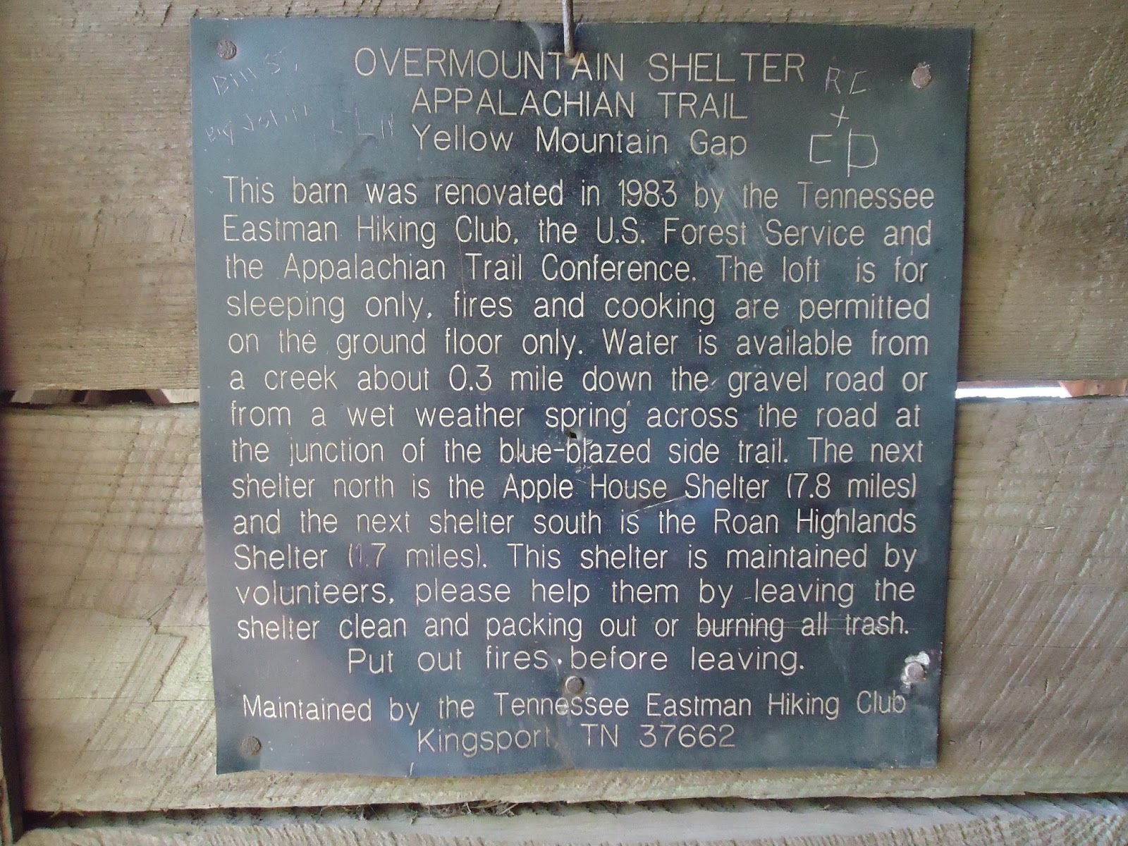
Today was pretty long. I woke up bright and early to start hiking. The hike today was filled with balds. I believe there were 4 or 5. I also visited the Overmountain Shelter, which is a barn converted into a shelter which can hold 20 hikers, possibly more. It also had a great view.

The two main obstacles of today's hike were Little Hump and Hump Mountains. Hump Mountain has a few false summits, so basically you think you've reached the summit, but then realize you have 100 more yards to go. That happened three times.

About halfway down from Hump, I saw a sign that says "Leaving NC." Technically, I have probably left NC a few dozen times so far (since the AT follows the NC-TN border for a few hundred miles), but this will be the last time. Alright, two states down, twelve to go! Let's do this! And goodbye NC! See you later!

Also, when I was on top of Hump, I could see Grandfather Mountain and Sugar Mountain (where Lutherock is), so that was pretty cool.

Tonight I am staying at a hostel, but it's full so I am tenting. There was a free shuttle into Roan Mountain (the town), so I went to a restaurant called Bob's Dairyland, and had the Holy Cow burger. It had three 5 oz hamburger patties, six slices of bacon, three slices of deli ham, three slices of cheese, two onion rings, and one scoop of chili. I also got a 32 oz mint chocolate chip milkshake. All worth it.

When I got back, some people in the hostel were watching Back to the Future, so I joined them, then we watched The Mask. It was all in all a pretty good night.

Unfortunately, around 10PM, a huge thunderstorm passed over. I was in my tent, in a deluge, and it didn't leak at all. I was bone dry all night, but the thunder and lightning were a bit unnerving, especially with a piece of fabric being the only thing separating me from them.


5/20/13 - Day 35 - Highest Shelter on the Trail

Cherry Gap Shelter to Roan High Knob Shelter
16.8 miles, 375.8 miles total

Overall, today was a good day. The weather was excellent, clear and sunny. But this morning was rough. Putting on soaking wet underwear, pants, socks, and shoes, and then hiking in them is quite possibly one of the most miserable things about the AT. Luckily, everything pretty much dried throughout the day.

Since it rained all night, some wildlife came out onto the trail that doesn't normally appear. I saw a lot of earthworms, as well as quite a few small orange salamanders.

Roan Mountain is one of the tallest mountains on the AT, and there is only one way to get to the top: climb. Okay, well, hike, but it was one of the most challenging ascents so far, especially since it was at the tail-end of my day.

This shelter is the highest one on the AT, sitting at nearly 6200 feet above sea level. Unfortunately, there isn't really a view to anywhere since the shelter is surrounded by pines. Tonight, in and around the shelter are Ninja, Mess, MacGyver, and Sugarpie (or something like that, I didn't really catch her name, she's headed south).