May 28th, 2013 - Day 43
Whitetop Mountain Road to Hurricane Mountain Shelter
22.7 miles, 510.9 miles total
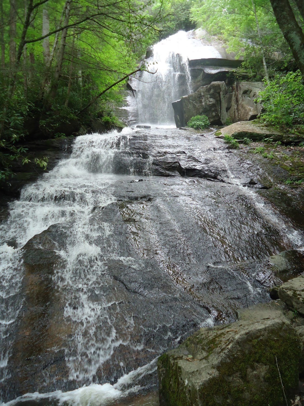
Well today was another long one, but it was definitely a good one. I saw a lot of cool stuff today. First of all, I passed by Mt. Rogers, the highest peak in Virginia. It's all downhill from here, kinda. Anyways, right around Mt. Rogers, I started to hear this loud booming noise that sounded like an airplane way up in the sky. The only thing different was that the noise kept getting louder, like really loud. And then I see it, and then it's gone. A fighter jet (probably an F-22 Raptor, according to Avo, who was in the Army) had just flown directly over and then banked over Mt. Rogers. It was a pretty neat experience. Throughout the day, I continued to hear fighter jets fly by in the distance. Later in the day, I also saw a V-22 Osprey flying in the distance. But I saw it twice, once as a helicopter, with its rotors horizontal, and then later, with its rotors vertical. It was quite interesting to be so close to such technology, and yet so far away.
Aside from the aircraft, I also saw plenty of wildlife today. Today I was in the Grayson Highlands State Park, where they have wild ponies that graze on the open fields of grass. A lot of times the ponies will simply walk up to you and not even be afraid. I have even heard stories of people waking up in a shelter to wild ponies sticking their heads in as if to say, "HEY! What are y'all doing in here?! Can I have some of that?" I also saw some cows and deer, and even a little fawn curled up in the bushes on the side of the trail.
Today I also passed by the "Fatman Squeeze", which is a rock tunnel on the AT, and it's actually quite difficult to get through with a pack on. I finally caught up with Avo, at a shelter in the late afternoon, where we were escaping an afternoon shower. Luckily, the rain let up just enough for us to reach our final destination for the night without getting too soaked.
Monday, July 15, 2013
May 27 - Day 42: Leaving Damascus
May 27th, 2013 - Day 42
Damascus, VA to Whitetop Mountain Road (tenting)
21.1 miles, 488.2 miles total
So today I got kind of a late start. It is always more difficult leaving town. First of all, your pack is about 10 lbs heavier because of all the food you are now carrying. Second, it is really easy to get used to the town life - not having to carry your pack everywhere, eating whatever you want, SODA. But luckily after a few miles back on the trail, it all comes back to you and you realize why you love hiking so much. After eating breakfast at a gas station/convenience store called Cowboy's (I know, sounds sketchy), I headed out on a full stomach.
The first few miles were quite rough, because they were all uphill and I had a full pack. I passed Frodo after only 4 miles even though he started 2 hours before me. He was clearly still recovering from his sudden sickness yesterday, and just didn't have the energy to go very fast.
One cool thing about Damascus is that the Virginia Creeper Trail goes straight through it. I have biked the VA Creeper multiple times, but I never knew it crossed the AT. It was fun being able to see it from a different perspective. I actually hiked up the VCT for a mile or so, because there was a detour in the AT. Apparently, one of the bridges got completely washed out, so the AT was rerouted onto the VCT for a bit.
I finally saw my first rattlesnake today! I was finally getting into a groove and was just zoned out, and the rattler completely startled me. I clearly startled it as well, because it immediately began shaking its tail at me. I wasn't going to continue with it sitting right next to the trail like that, so I simply waited for it to move on. Rattlesnakes are venomous and their bites can be fatal depending on the amount of venom they decide to inject. A rattler that was simply startled like this one (vs being stepped on or provoked) would be less likely to inject a fatal amount of venom, or any venom at all.
Anyways, I got to a shelter around 5:30 or so, but I was really eager to catch up with Avo, who left Damascus yesterday, so I decided to push on to a campsite near the summit of Whitetop Mountain...meaning my final 5 miles or so would be all uphill. I finally reached the campsite around 8PM and now I feel extremely accomplished. Another long day awaits, and I have a good feeling I will sleep very well tonight.
Sunday, July 14, 2013
How to make a mid afternoon snack on the AT
1. Lay out necessary food items - 1/2 block cheddar cheese, 1/2 summer sausage, and one tortilla shell - on a firm, clean cutting surface (in this case a tortilla bag overlying a pad in a mice infested shelter). It may also be helpful to wear as ridiculous clothing as possible.

2. Using a sharp knife, carefully slice the summer sausage being careful not to puncture the underlying tortilla shell.

3. Carefully slice several days old, unrefigerated cheddar into small blocks.

4a. Lay out sausage and cheese on tortilla in a beautiful presentation - this is art after all.
4b. (optional) Indulge in extra cheese, clearly an ethereal event.

5. Fold tortilla and enjoy.

-- Phillip Bostian
Guest poster: Phillip A. Bostian 7/1-7/5 Rain, Rain, and more Rain
I told Adam a while back that if he did indeed decide to
hike the Appalachian trail that I would come and spend a week with him. My
resume as a hiker and backpacker is not stunning, but I do have some experience
out on the trail. I knew it would be difficult for me to go from sitting all
day to hiking with a thru-hiker, but I nevertheless set out to do just that. We
decided to meet at REI that Sunday at 11:00, as Adam was coming from Charlotte
and I was coming from Greenville (NC). We met and picked up a few obligatory
items including some maps and a stove for me. Adam bought some tights for the
trail (and yes I mean spandex/lycra pants). -->

Finally, we departed for Thunder
Ridge overlook on the blue ridge parkway where I would leave my car, a three
hour ride away. On the way we picked up some lunch and a Subway sandwich for dinner
that night. We arrived at Thunder Ridge overlook at 2:45 and found just two
other cars in the parking lot. It was somewhat overcast and I was afraid the
clouds would open up at any moment, so I pushed Adam to hurry up. I was quickly
reminded that Adam moves at his own pace. Finally, after taking the obligatory
photo at the overlook, we set off into the woods. -->

Our hike into camp was only 5
miles, with a large portion of it being downhill. Luckily for me, Adam had just
taken a two week hiatus from the trail and was wanting to ease back into
things. I was able to keep up quite well until our first significant up hill,
Highcock knob, which rises only about 600 feet from its surroundings over about
a mile.

(We began the afternoon at Thunder Ridge Overlook on the BRP. Our destination for the day was Marble Spring Just past mile 31)
[Highcock knob is so named for a legendary bear hunter who had a cabin
in this area. It is said that he had to roosters that would perch high in oak
trees to cast their crow across the valley, and thus the name high cock knob.]
As I ascended this small peak, my quads began to burn and I quietly began to
cuss this mountain under my breath. After reaching a small summit, I found Adam
sitting out on a small rock outcropping looking at his guidebook. He quickly
informed me that we were at the top and the rest of the hike was downhill into
camp. I think he was partly informing me and partly encouraging me. I thanked
my lucky stars as I struggled to catch my breath. I decided to push on instead
of breaking, thinking that I could possibly beat Adam into camp. Instead, I
quickly discovered that Adam had not been the most astute orienteersman as I
found that the trail continued steeply upward right past where I had found
Adam. Again, he passed me as I laboriously climbed until reaching the top.
Finally, I was on the downhill section. We arrived at the Marble Springs
campsite between 5:30 and 6:00, a pace which is not bad for an unseasoned
backpacker. We quickly set up camp and ate the sub sandwiches that we had
packed in for our first dinner. Not long after dinner, we gathered our water
bottles and hiked a short distance down to the spring that is right outside of
camp. This was an interesting water source in that it was only a small trickle
coming out of the side of the hill and after only 30 feet or so disappeared
back into the mountain through a sieve of sand and rocks. We quickly filled our
water bottles – Adam used a squeeze filter to purify his water and I opted for
the lazier (and safer) tablets to treat my water.
 (This is Adam using his squeeze purifier at another camp. Sorry for poor quality - it was raining)
While hiking back into camp, we began hearing thunder and a curt drizzle beckoned a strong downpour. We spent the next hour and a half in the tents until the rain stopped. I sat in my tent looking at the map and reading about the Appalachian trail in my guidebook. During this time, I realized my tent was not as waterproof as it had once been. Notably, several of the seams were leaking and rainwater was beginning to pool between the groundcloth and the tent floor (this was a result of poor tent pitching as I had left the groundcloth edge exposed to the runoff from the rainfly). Once the weather broke for a few minutes we gathered back outside and hung our bear bags and brushed our teeth. Shortly after, the rain settled back in for the night and we headed off to bed.

While hiking back into camp, we began hearing thunder and a curt drizzle beckoned a strong downpour. We spent the next hour and a half in the tents until the rain stopped. I sat in my tent looking at the map and reading about the Appalachian trail in my guidebook. During this time, I realized my tent was not as waterproof as it had once been. Notably, several of the seams were leaking and rainwater was beginning to pool between the groundcloth and the tent floor (this was a result of poor tent pitching as I had left the groundcloth edge exposed to the runoff from the rainfly). Once the weather broke for a few minutes we gathered back outside and hung our bear bags and brushed our teeth. Shortly after, the rain settled back in for the night and we headed off to bed.
The next morning, I arose early determined to be a better
hiker than I had been the day before. It was no longer raining, but was
overcast and a heavy fog had settled in. I packed my wet tent and damp sleeping
bag into my damp backpack. I quickly packed the rest of my gear and was ready
to start hiking as Adam emerged from his tent. So, I set off without Adam but
thought for sure he would pass me soon. The trail today was mostly flat with
some downhills, but no significant uphills. I made good time on the flat part
and was feeling strong. After an hour into my hike, the rain started back up
and would not stop until camp. I found a long stretch of wild blueberries and
stuffed a few in my mouth as I went along. Soon, I arrived at the James river.
This is the longest river in Virginia, and coincidentally, also the site of the
longest footbridge on the Appalachian Trail. I stopped here, thinking Adam was
right around the corner and we could cross the bridge together.


After 30
minutes, I strapped my backpack back on and finished the next couple miles to
John’s Hollow Shelter without Adam. [John’s Hollow (pronounced holler) is named
after a local hermit who was known to live in this area. It is supposedly well
known for its abundance of wildflowers, although we did not see any while
there] Upon arrival, I met a young lady there with a thick Australian accent
who went by the trail name of “Wombat” [On the Appalachian trail, hikers do not
use their given names. Instead they use aliases often dubbed “trail names”.
These are often given to them by other hikers or simply assumed on their own.
Adam’s name is “Zeus”]. She is a physical education teacher from Australia who
was hiking for a few days before going to a wedding. Soon, Adam showed up and
Wombat headed out. The clouds finally gave way to blue sky and we set out
drying our wet clothes and gear on a clothesline behind the shelter.

(Adam drying stuff out at John's Hollow)
Since we
had gotten into camp before lunch, we had quite a bit of time to burn. I spent
my time going down to the creek and washing up, reading about the section of
trail we were to hike the next day, playing solitaire, and whittling. Adam
spent most of his time in a novel.

For dinner, we each had a Mountain House
meal of beef stroganoff, which was quite good. We were by ourselves in camp that
night, and I was glad we decided to stay in the shelter as it once again began
to rain.
The next morning, I once again beat Adam out of camp and
began a difficult uphill climb. On this day, we had a 2000 foot climb directly
out of our camp.

(Our hike for the day was from John's Hollow Shelter to Punchbowl Shelter. The elevation gain between horizontal lines is 500 ft.)
I definitely wanted to get a head start on Adam, as I was sure
he would quickly pass me on the uphill portion. Well, I reached the top of our
initial ascent and decided to wait for Adam, as I was feeling a little guilty
about not actually hiking with him. After about 45 minutes, he finally emerged
from below me. Come to find out, he had left an hour after I had. We continued
to ascend up Rocky Row mountain. It had been raining all morning, but now all
hell broke loose. An absolute deluge drenched us for the next two hours. I
swear I have stood in the shower and been drier. Every inch of me was soaked.
It rained so hard that many of the smaller trees bent over, unable to withstand
the onslaught. [Later I learned that the record daily rainfall total was set in
nearby Blacksburg and Roanoke.] Finally, somewhere before our ascent of Bluff
mountain, the pouring rain gave way to a measly drizzle. We ascended Bluff
mountain and just before the summit we paid our respects to little Ottie Cline
Powell.

(Internet photo of the marker near the summit of Bluff Mountain memorializing the place where the four year old Ottie Cline Powell's body was found)
[Ottie Powell was a four year old from the 1800s who wandered away from
his schoolhouse while collecting firewood in November. Despite an extensive
search, his body was not recovered until the next April at the summit of Bluff
mountain. He is said to haunt nearby Punchbowl shelter, our shelter for the
evening. You can read the story here: http://blueridgecountry.com/archive/favorites/ottie-cline-powell/]
We arrived at the summit of the mountain, which is known for its breathtaking
vistas. The only thing breathtaking for me was how drenched I was at the
moment, as the mountain was still socked with fog. Soon, we began our descent
to Punchbowl shelter. [Punchbowl shelter is so named for the small pond in its
front yard.-->

(Notice the small pond. Picture taken from the from of Punchbowl Shelter)
The next morning, it continued to rain (see a trend here?)
and we set out on our mostly flat hike to Brown Mountain Creek Shelter. This
hike was quite easy and we made good time. Much of the walk is alongside a
large reservoir and a protected demonstration forest. It drizzled most of the
time, but we were able to dry out a little bit from the day prior. Just as soon
as our shoes were starting to dry out, we came to a stream crossing that was
swollen from days of rain and were forced to submerge our shoes in the water –
once again we were walking in sopping shoes. Soon we found ourselves along the
Brown Mountain Creek, and later in the Brown Mountain Creek Shelter.-->

It continued to rain throughout the night and was drizzling
the next morning. This was the last day on the trail for me, and we had been
told it was supposed to clear up today. Again, I was the first one up and
quickly packed up my things. I had tossed and turned all night and had not
slept well, so I was ready to get moving and head to our pick up point.
Originally, we had planned to head to Spy Rock Rd., about 20 miles from Brown
Mountain Creek, but we decided to have the family pick us up at Salt Log Gap, a
mere 10 miles from the current location. I began walking, although my pace was
slow due to left Achille’s pain. The hike was uphill for the first five miles
and was the most difficult hike I had while on the trail. After many false summits,
I reached the 4,000+ ft Bald knob, whose summit is ironically forested. This
was a total of 2500 feet of elevation gain since camp, and I was glad to have
it behind me. Next we descended to Cow Camp Gap and then began our ascent of
Cold Mountain. In contrast to Bald Knob, Cold Mountain has a bald summit and
would have had great views if it had not been raining and foggy.-->

--Phillip Bostian, July 2013
Mom’s AT Journey – July 4th Weekend
Mom's Sub-Blog
Joined Adam “on the AT,” or perhaps I should say “near the
AT” for a few days over the 4th of July holiday. I felt like I was part of the journey.
Adam and Phillip hiked together from June 30 – July 4,
giving Phillip a taste of Adam’s trek.
Phillip brought bad weather with him though, and it rained most of the
time the two of them were on the trail together.
They made it 50 miles, though, and we picked them up on the
4th on VA highway 664, a narrow dirt road running along a river
. There was a definite hiker aroma to
the two of them when we greeted them, but we still loved them and drove them to
the Wintergreen condo we rented.
Dinner: pizza delivered!
On July 5, Adam agreed to “slack pack,” meaning he carried
his necessities with him, but left his tent and backpack with us. With this light load, he was able to hike 27
miles for the day, and Phil and Phillip dropped him off where we had picked up
on July 4th, and picked him up at the end of the day at Reed’s Gap
at the Blue Ridge Parkway near our condo.
Adam slack packed 18 miles again the next day, most of the
time running along the northern end of the Blue Ridge Parkway. We even met him for lunch at Humpback Rocks,
and then Phil and I picked him up at the terminus to the Parkway, Rockfish Gap,
near Waynesboro. There, we took him to
resupply – he bought socks, duct tape, and food including dehydrated favorites,
Mountain House meals. With this food,
all you add is hot water – high calories, high energy and apparently delish!
We dropped Adam off at Reid’s gap again, where Phillip and
Amanda and Reed met him for the night, and Phil and I headed back to
Charlotte.
My most difficult part of this AT weekend was saying goodbye
at Reed’s Gap. At that point, Adam was at
852.5 miles of his 2,184 mile trek, with more than 1300 miles left to journey,
and he was now to be leaving the mountains that I felt that I knew. I knew that at that point, he was truly on
his own – not an easy drive for us, not mountains we knew, and not close to
friends or family. He was fully
independent, just doing what he’s doing – thru-hiking the Appalachian Trail
through the remaining 150 miles of Virginia, the four miles of West Virginia
and on to Maryland, Pennsylvania, NJ, NY, CT, MA, VT, NH and finally in late September
to Mt. Katahdin, Maine. 1300 miles to go!
It’s lonely for us, but we’ll hear from Adam when he can
call. I’m proud of him. He is self-sufficient, he has a plan, he’s
adaptable, he’s decisive – and he is doing what he has dreamed of for several
years.
Do all AT moms feel this way? Scared, but proud – and maybe a little
jealous? I think we should all be
willing to take a risk and to enjoy our journeys in the world God has given
us! I’m glad Adam is doing just that.
Posted by Abby Bostian, at the Charlotte Home Shelter, July, 2013
Sunday, July 7, 2013


Subscribe to:
Posts (Atom)